|
Northland Regional Council
Northland (), officially the Northland Region, is the northernmost of New Zealand's 16 local government regions. New Zealanders sometimes refer to it as the Winterless North because of its mild climate all throughout the year. The major population centre is the city of Whangārei, and the largest town is Kerikeri. At the 2018 New Zealand census, Northland recorded a population growth spurt of 18.1% since the previous 2013 census, placing it as the fastest growing region in New Zealand, ahead of other strong growth regions such as the Bay of Plenty Region (2nd with 15%) and Waikato (3rd with 13.5%). Geography The Northland Region occupies the northern 80% () of the Northland Peninsula, the southernmost part of which is in the Auckland region. It is bounded to the west by the Tasman Sea, and to the east by the Pacific Ocean. The land is predominantly rolling hill country. Farming and forestry occupy over half of the land and are two of the region's main industries. Although ... [...More Info...] [...Related Items...] OR: [Wikipedia] [Google] [Baidu] |
Regions Of New Zealand
New Zealand is divided into sixteen regions for local government in New Zealand, local government purposes. Eleven are administered by regional councils, and five are administered by Unitary authority#New Zealand, unitary authorities, which are territorial authorities of New Zealand, territorial authorities that also perform the functions of regional councils. Although technically a district but classed as a territory, The Chatham Islands Territory is outside the regions and is administered by the Chatham Islands Council, which is similar to a unitary authority, authorised under its own legislation. Current regions History and statutory basis The regional councils are listed in Part 1 of Schedule 2 of the Local Government Act 2002, along with reference to the ''New Zealand Gazette, Gazette'' notices that established them in 1989. The act requires regional councils to promote sustainable developmentthe social, economic, environmental and cultural well-being of their communitie ... [...More Info...] [...Related Items...] OR: [Wikipedia] [Google] [Baidu] |
Kerikeri
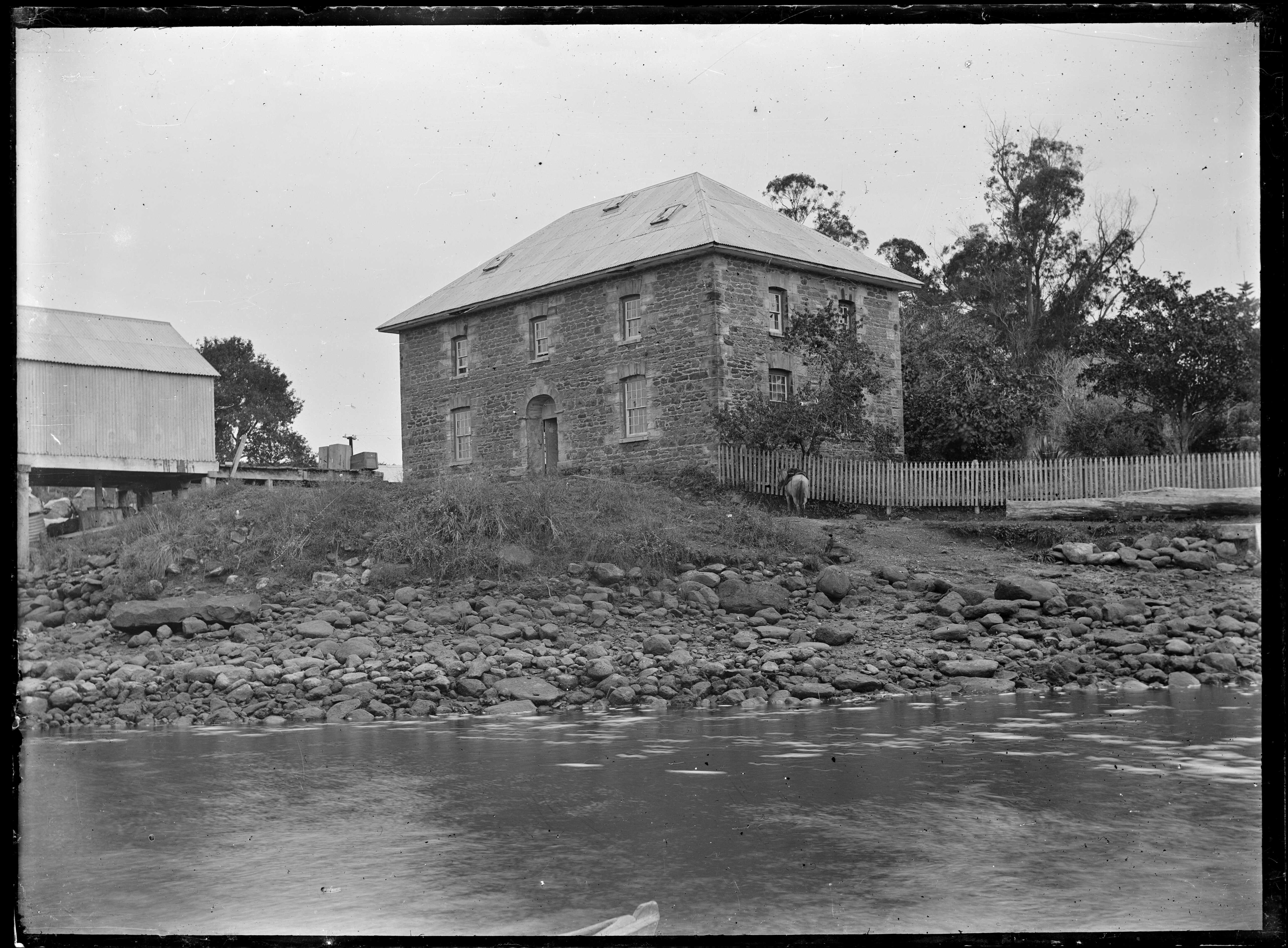
Kerikeri () is a town in the Bay of Islands, in the Far North District of the North Island of New Zealand. It lies at the head of Kerikeri Inlet, a northwestern arm of the Bay of Islands, where fresh water of the Kerikeri River enters the Pacific Ocean. It is sometimes called the Cradle of the Nation, as it was the site of the first permanent Christian mission station in the country, and has some of the oldest buildings in the country. It is a rapidly expanding centre of subtropical and allied horticulture. Naming The missionaries who established the settlement of Kerikeri initially called it Gloucester Town, but this name did not see continued use. The etymology of ''Kerikeri'' is unknown with several origins suggested; one possible origin is from the Māori language verb meaning 'to dig'. History In , Ngāpuhi conquered the area from another iwi (tribe). In 1814, Samuel Marsden acquired land at Kerikeri from Hongi Hika for the use of the Church Missionary Society for ... [...More Info...] [...Related Items...] OR: [Wikipedia] [Google] [Baidu] |
Hokianga
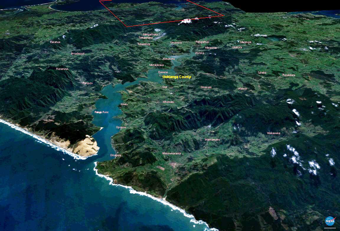
The Hokianga is an area surrounding the Hokianga Harbour, also known as the Hokianga River, a long Estuary, estuarine drowned valley on the west coast in the north of the North Island of New Zealand. The original name, still used by local Māori people, Māori, is ''Te Kohanga o Te Tai Tokerau'' ("the nest of the northern people") or ''Te Puna o Te Ao Marama'' ("the wellspring in the world of light"). The full name of the harbour is Te Hokianga-nui-a-Kupe — "the place of Kupe's great return". Geography The Hokianga is in the Far North (district), New Zealand, Far North District, which is in the Northland Region. The area is northwest of Whangārei City—and west of Kaikohe—by road. The estuary extends inland for from the Tasman Sea. It is navigable for small craft for much of its length, although there is a bar across the mouth. In its upper reaches the Rangiora Narrows separate the mouths of the Waihou and Mangamuka Rivers from the lower parts of the harbour ... [...More Info...] [...Related Items...] OR: [Wikipedia] [Google] [Baidu] |
Waipoua Forest
The Waipoua Forest is a forest, on the west coast of the Northland Region of New Zealand's North Island. It preserves some of the best examples of kauri forest remaining in New Zealand. It is notable for having two of the largest living kauri trees, ''Tāne Mahuta'' and '' Te Matua Ngahere''. The forest was declared a sanctuary in 1952. A community-based volunteer organisation, the Waipoua Forest Trust, helps maintain the forest. The sanctuary is bordered to the south by the Professor W.R McGregor Reserve, named after W. R. McGregor (1894–1977). In the 1940s, McGregor, and others, successfully campaigned to end logging of the forest and to have it declared a sanctuary, a status it achieved in 1952. Approximately 200,000 people visit Tāne Mahuta every year. This has led to concerns about the health of the forest and the spread of kauri dieback disease. Ecology The Waipoua, Warawara and Puketi forests together contain about three quarters of New Zealand's remaining mature ... [...More Info...] [...Related Items...] OR: [Wikipedia] [Google] [Baidu] |
Tāne Mahuta
Tāne Mahuta, also called "God of the Forest", is a giant Agathis australis, kauri tree (''Agathis australis'') in the Waipoua Forest of Northland Region, New Zealand. Its age is unknown but is estimated to be between 1,250 and 2,500 years. It is the largest living kauri tree known to stand today. It is named after Tāne, the Māori language, Māori god of forests and of birds. The tree is a remnant of the ancient subtropical rainforest that once grew on the Northland Peninsula. Other giant kauri are found nearby, notably Te Matua Ngahere. Tāne Mahuta is the most famous tree in New Zealand, along with Te Matua Ngahere. It was discovered and identified in early January 1924 when contractors surveyed the present State Highway 12 (New Zealand), State Highway 12 route through the forest. In 1928, Nicholas Yakas and other bushmen, who were building the road, also identified the tree. In April 2009, Tāne Mahuta was formally partnered with the tree Jōmon Sugi on Yakushima Island, ... [...More Info...] [...Related Items...] OR: [Wikipedia] [Google] [Baidu] |
Kauri
''Agathis'', commonly known as kauri or dammara, is a genus of evergreen coniferous trees, native to Australasia and Southeast Asia. It is one of three extant genera in the family Araucariaceae, alongside '' Wollemia'' and ''Araucaria'' (being more closely related to the former).de Laubenfels, David J. 1988. Coniferales. P. 337–453 in Flora Malesiana, Series I, Volume 10. Dordrecht: Kluwer Academic. Its leaves are much broader than most conifers. Kauri gum is commercially harvested from New Zealand kauri. Description Mature kauri trees have characteristically large trunks, with little or no branching below the crown. In contrast, young trees are normally conical in shape, forming a more rounded or irregularly shaped crown as they achieve maturity.Whitmore, T.C. 1977. ''A first look at Agathis''. Tropical Forestry Papers No. 11. University of Oxford Commonwealth Forestry Institute. The bark is smooth and light grey to grey-brown, usually peeling into irregular flakes t ... [...More Info...] [...Related Items...] OR: [Wikipedia] [Google] [Baidu] |
Tasman Sea
The Tasman Sea is a marginal sea of the South Pacific Ocean, situated between Australia and New Zealand. It measures about across and about from north to south. The sea was named after the Dutch explorer Abel Janszoon Tasman, who in 1642 was the first known person to cross it. British explorer Lieutenant James Cook later extensively navigated the Tasman Sea in the 1770s during his three voyages of exploration. The Māori people of New Zealand call this sea ''Te Moana-a-Rehua'' meaning 'the sea of Rehua' which clashes with the Pacific waters named ''Te Tai-o-Whitirea'' ('the sea of Whitirea') – after Whitirea, Rehua's lover – at Cape Reinga, the northernmost tip of North Island. Climate The south of the sea is passed over by depressions going from west to east. The northern limit of these westerly winds is near to 40th parallel south, 40°S. During the southern winter, from April to October, the northern branch of these winds from the west changes its direction toward th ... [...More Info...] [...Related Items...] OR: [Wikipedia] [Google] [Baidu] |
The Encyclopedia Of New Zealand
''Te Ara: The Encyclopedia of New Zealand'' is an online encyclopedia established in 2001 by the New Zealand Government's Ministry for Culture and Heritage. The web-based content was developed in stages over the next several years; the first sections were published in 2005, and the last in 2014 marking its completion. ''Te Ara'' means "the pathway" in the Māori language, and contains over three million words in articles from over 450 authors. Over 30,000 images and video clips are included from thousands of contributors. History New Zealand's first recognisable encyclopedia was ''The Cyclopedia of New Zealand'', a commercial venture compiled and published between 1897 and 1908 in which businesses or people usually vanity press, paid to be covered. In 1966 the New Zealand Government published ''An Encyclopaedia of New Zealand'', its first official encyclopedia, in three volumes. Although now superseded by ''Te Ara'', its historical importance led to its inclusion as a separate ... [...More Info...] [...Related Items...] OR: [Wikipedia] [Google] [Baidu] |


